
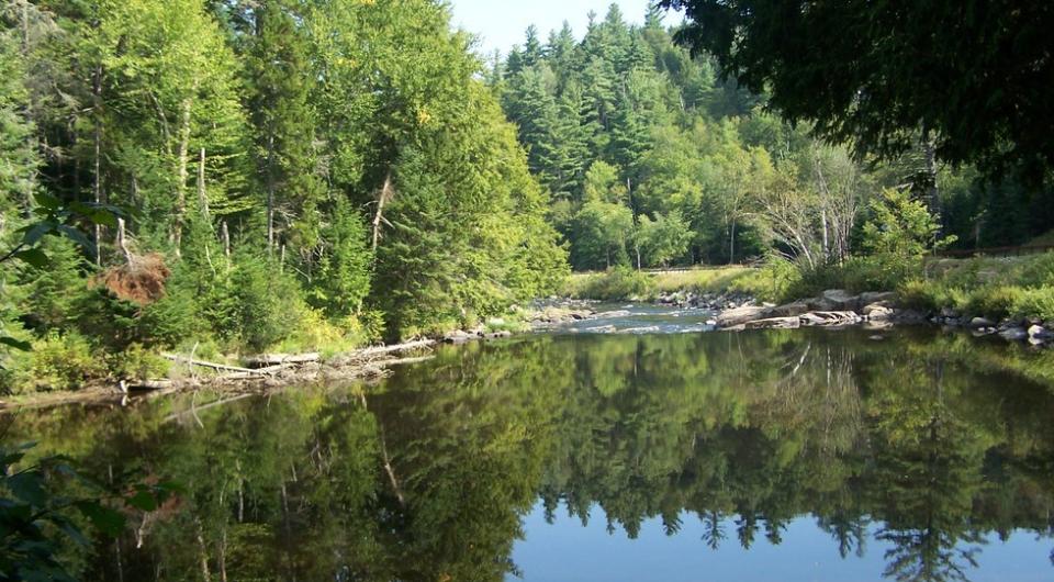
Water's Edge Trail
44.508504, -73.479652
Travel a winding loop along the Ausable River, with views of the Adirondack Mountains and river valleys. Fun fact: Clintonville (which the route passes through) almost became the capital of New York state!
By the numbers
- 27.3 miles round trip
Cycling
This route has river and mountain views, with some heavier traffic areas with limited shoulders. There are services in Au Sable Forks.
Map and turn-by-turn directions on the PDF, and also at the Lake Champlain Bikeways website.

Packages and Promotions
range
Valid Sep. 12 - Sep. 13
Valid Apr. 30 - May. 30
BikeADK loves Canada - Handlebarley
Canadian Residents can use the code “BikeADKLovesCanada" will receive 15% off their registration!
promotion
recurring
Valid
Valid
weekly on Monday, Tuesday, Wednesday and Thursday until April 17, 2025
Lake Hour at Portside Restaurant
It's better than Happy Hour! Enjoy Lake Hour from 5 to 6pm on Mondays through Thursdays in July and August at Portside Restaurant, on stunning Lake Champlain. Portside often features loc...
package
1
week
MO,TU,WE,TH
MO
range
Valid Apr. 14 - May. 17
Valid Apr. 7 - May. 17
Mother's Day Stay - the gift mom really wants!
The Chateau on Dock Street
The Chateau on Dock Street
Give mom the gift she really wants this Mother's Day - bring the whole family together under one roof!
This spacious, lakefront home is th
package
range
Valid Apr. 14 - May. 17
Valid Apr. 9 - May. 17
Third Night Free for Mother's Day Weekend!
The Chateau on Dock Street
The Chateau on Dock Street
Give mom the gift she really wants this Mother's Day - bring the whole family together under one roof!
This spacious, lakefront home is th
package
recurring
Valid
Valid Apr. 24 - Aug. 30
weekly on Monday, Tuesday, Wednesday and Thursday until August 31, 2025
Portside Restaurant
Portside at Westport Marina (seasonal)
Portside at Westport Marina (seasonal)
"Lake Hour" is better than Happy Hour! Enjoy drink discounts while sitting on Lake Champlain at Portside Restaurant.
promotion
1
week
MO,TU,WE,TH
MO

